


You are here
Greenbelt Alliance


Vote NO on Measure D to Reject Voter Approval for Parking Plaza Development Los Altos
This November, Los Altos voters should reject a proposal that could take away local decision-making power when it comes to planning the future of their City. Proposed Measure D would require a citywide vote before any change to a parking plaza, whether it’s housing or a theater, or adding bicycle or EV parking.
The No on Measure D Los Altos campaign highlights multiple reasons to reject the proposal, including:
- Measure D Would Trigger a Lawsuit and Millions in Legal Fees
- Measure D Risks Losing Local Control Over Zoning
- Measure D Would Eliminate Over 200 Parking Spaces, the Opposite of Its Goal
- Once Passed, Measure D Can Only Be Fixed by Another Costly Vote
Learn more about the campaign and get resources here.
This measure takes away the City’s ability to implement critical policies that have been vetted through years of planning for the downtown’s future, and threatens progress for affordable housing and climate goals.
Why It MattersThe measure would take decisions out of the City Council and planning commissions’ hands on how to best plan new housing and critical infrastructure. Measure D weaponizes the initiative process to stifle infill housing and prevent improvement of existing use of urban space.
According to YIMBY Law, Los Altos risks falling out of compliance with its Housing Element and puts the city at risk of litigation if this measure were to pass. Falling out of compliance with the Housing Element would trigger the “builder’s remedy,” which removes local decision-making over land use at the local level.
Decisions at this scale should not go to a citywide vote every time, and should remain at the discretion of the City Council. For example, even with parking lots that would remain in current use, voters would have to approve minor additions such as bicycle or EV parking. Because of this barrier to building infrastructure for low-carbon modes of transportation, the City’s own analysis of the measure highlighted that if Measure D passes, the City would be in a difficult position to meet its goal of Carbon Neutrality by 2025.
As examined in SPUR’s 2024 White Paper, Planning by Ballot, measures like these often hamper housing production and have additional negative externalities, in this case preventing the City’s ability to meet its climate goals.
A similar measure is currently being proposed for Menlo Park; Learn more about No on P in Menlo Park.
Advocates for No on Measure D see a better path for planning for downtown’s future (without a ballot freeze): “The city has spent over a decade engaging residents on downtown’s future, balancing housing obligations, merchant parking needs, and community gathering space. Measure D forecloses that balancing process, locking in one outcome “for any reason” with no way to adjust as circumstances change. Change is coming to downtown, driven by changing consumer behavior, vehicle technology, and state housing law. The real choice is whether it happens through adaptable planning or a rigid measure that can’t respond to what’s learned along the way.”
Vote no on Measure D this November.
The post Vote NO on Measure D to Reject Voter Approval for Parking Plaza Development Los Altos appeared first on Greenbelt Alliance.
Vote NO on Measure P to Protect Affordable Housing in Menlo Park
To protect affordable housing in Menlo Park, Greenbelt Alliance urges voters to say NO on Measure P, the Downtown Parking Plazas Ordinance. We join a strong coalition of advocates that support more homes in the City’s downtown.
As part of California’s Regional Housing Needs Allocation process (learn more here), Menlo Park decided in its Housing Element (a state-mandated housing plan) to prioritize converting three downtown surface parking lots into affordable housing by partnering with nonprofit affordable housing developers, something that Greenbelt Alliance supported and advocated for with many partner organizations. Additional parking would then be added in a new parking structure to ensure adequate supply. However, some downtown businesses and residents are opposed to this plan and have gathered signatures to place a referendum on the ballot that would require a citywide vote for any changes to parking lots, preventing affordable housing from being built at a time when Menlo Park needs to prioritize it.
If Measure P were to win at the ballot box, it would knock the city out of compliance with state regulations and open Menlo Park up to numerous financial and other penalties, including the Builder’s Remedy, which nullifies local laws around height and density.
Learn more about the campaign here.
Why It Matters
Like many cities across the Bay Area, Menlo Park has a severe housing shortage, particularly when it comes to affordable homes for lower-income families. This has been the case for many years, but significant job growth in the tech sector over the last decade has caused prices to skyrocket, both regionally and locally.
The extreme housing shortage also impacts the climate and environment. Because job and housing growth has not been balanced, thousands of people commute into Menlo Park every day, spending hours in their cars driving many miles to get there. To reduce vehicle miles traveled (VMT) and greenhouse gas emissions, Menlo Park and other cities like it on the peninsula and the western half of the Bay Area must seriously commit to building affordable housing, particularly near transit and in their downtowns.
Menlo Park should simply make good on its promise to the state: recommit to building affordable housing on the downtown surface parking lots. Rejecting Measure P will benefit local families struggling with housing affordability, help ensure a thriving downtown by creating more customers for local businesses, and protect our climate and environment. Vote NO on Measure P.
The post Vote NO on Measure P to Protect Affordable Housing in Menlo Park appeared first on Greenbelt Alliance.
Vote Yes on Measure L to Protect Cupertino’s Parks and Open Space for Good
This November, Cupertino voters have the chance to make sure their parks and open spaces stay just like that.
Greenbelt Alliance proudly endorses a YES vote on Measure L, which would require two-thirds voter approval before the City could rezone any designated park, parkland, or open space for residential, commercial, or industrial use, or approve development on that land. In short, it puts the decision about Cupertino’s green space in the hands of voters, not subject to a simple council majority.
Why It MattersParks and open space are not just amenities. They are the places where Cupertino residents cool off during extreme heat, where stormwater is absorbed instead of flooding streets, and where kids and families get safe, free access to the outdoors. As Silicon Valley continues to face intense development pressure, the land we set aside for community and ecological health is exactly the kind of asset that can quietly disappear, parcel by parcel, without anyone getting a real say.
Measure L does not ban future changes to parkland outright. It simply raises the bar, requiring a supermajority of voters to sign off before park or open space land is converted into something else. The higher threshold protects against short-term political or financial pressure driving long-term irreversible decisions about land that belongs to the whole community.
Measure L comes at no cost to taxpayers and gives Cupertino residents a durable, voter-backed layer of protection for parks and open space, ensuring any future development in these valuable areas has to clear a high bar and earn broad community support first.
Protecting green space is protecting climate resilience. Vote YES on Measure L in Cupertino.
The post Vote Yes on Measure L to Protect Cupertino’s Parks and Open Space for Good appeared first on Greenbelt Alliance.
Vote Yes on Measure Q to Unlock Affordable Housing for Seniors in Half Moon Bay
Smart, sustainable growth means building the housing our communities need in places that protect both people and our environment—which is why Greenbelt Alliance is proud to endorse Measure Q in Half Moon Bay.
Measure Q asks voters to approve a 99-year ground lease and related agreements between the City of Half Moon Bay and affordable homebuilder Mercy Housing. This approval is the final key to unlocking a transformational 40-unit affordable housing community specifically designed for senior farmworkers at 555 Kelly Avenue.
Why It MattersThis project represents the very best kind of infill development. Located in the heart of downtown Half Moon Bay, 555 Kelly sits just steps away from vital daily services, grocery stores, local retail, and community spaces. By placing deeply affordable housing in a walkable, central location, it’s possible to reduce reliance on personal vehicles, lower greenhouse gas emissions, and connect some of the city’s most vulnerable residents directly to their town’s core.
Equally important is climate resilience. As the coast faces increasing climate threats, this downtown site ensures senior farmworkers, the very people who have nourished our region for decades, have dignified, safe, and affordable housing in a location protected from severe climate hazards. It honors their lifelong contributions by offering a secure, comfortable space to age in place with dignity.
While a “Yes” vote affirms the City Council’s approval of the ground lease, allowing Mercy Housing California to move forward seamlessly with construction, a “No” vote blocks the ground lease and brings this long-awaited project to a screeching halt. If that were the case, it would also leave Half Moon Bay’s Housing Element in a continued state of non-compliance, exposing the city to escalating legal penalties, substantial state fines, the potential loss of critical state grant funding, and the Builder’s Remedy.
Yes on Q is the right choice for housing affordability, for climate resilience, and for the Half Moon Bay community. Vote YES on Measure Q.
Photo credit: Visit Half Moon Bay, Facebook Page.
The post Vote Yes on Measure Q to Unlock Affordable Housing for Seniors in Half Moon Bay appeared first on Greenbelt Alliance.
Vote Yes on Measure L To Put Climate Resilience on San Mateo County’s Charter
This November, San Mateo County voters have a chance to do something few counties in California have done: write climate resilience directly into their charter. Greenbelt Alliance proudly endorses a YES vote on Measure L, the County’s Charter Amendment on Extreme Weather events, on the ballot.
Measure L would amend the preamble of the San Mateo County Charter to designate long-term resilience to extreme weather events, including fire, flood, wind, rain, heat, drought, and sea level rise, as a County priority.
Why It MattersMost climate resilience commitments live in strategic plans, resolutions, or budget line items. Those tools matter, but they can be rewritten or quietly dropped by a future board with different priorities. A charter is different. It’s the County’s foundational governing document, the one that outlives every single Board of Supervisors, budget cycle, or election.
That’s what makes Measure L significant. It sets a precedent for both San Mateo County and for the rest of the state. Very few California counties have named climate resilience as an enumerated priority in their charter. If Measure L passes, San Mateo County will become a model other Bay Area counties can point to when making the case for similar charter language at home.
The measure’s emphasis on collaboration with cities, districts, and other public entities also matters in practice. San Mateo County’s extreme weather risks, coastal flooding in places like San Mateo and Half Moon Bay, wildfire in the western hillsides, and extreme heat inland do not stop at jurisdictional lines. A charter mandate for the county to work across those lines gives future resilience hubs, shoreline adaptation projects, and emergency preparedness efforts a clearer foundation to build on, rather than relying on goodwill between agencies.
Measure L does not create a new tax, program, or agency. It changes how the county defines its own priorities, at the level of its governance charter, in a way that is significantly harder for a future board to unwind than a policy or ordinance would be.
If you want to vote for climate resilience this November, vote YES on Measure L in San Mateo County.
The post Vote Yes on Measure L To Put Climate Resilience on San Mateo County’s Charter appeared first on Greenbelt Alliance.
Vote Yes on Measure X in Sausalito
Greenbelt Alliance encourages voters in Sausalito to say YES to Measure X.
This measure amends and modernizes Ordinance 1022, passed by voters in 1985, and retires the Marinship Specific Plan.
The Ordinance was initially created to reduce traffic from new development and preserve the maritime character of the commercial and industrial zones. Forty years later, those same rules now prevent waterfront businesses from growing, thriving, and adapting. Buildings are aging, infrastructure is crumbling, streets are flooding, and office buildings stand half vacant. Because 1022 was created by a citywide voter initiative, only a new citywide voter initiative can change it.
Why It MattersAs a Bay Area organization committed to ensuring the Bay Area’s lands and communities are resilient to a changing climate, we support Measure X.
Utilizing developed footprint more effectivelyDecades ago, Marin County had the foresight to protect ridgelines, farmland, watersheds, and open space. Doing so protected our important natural resources, but it also limited space for our built environment. That means we must build more efficiently to make the most of our limited development footprint. But current Sausalito planning processes are slowing down the pace of progress.
By saying Yes on X, routine land-use decisions return to normal city government processes (with public hearings, environmental review, and community input). No ballot would be required for everyday decisions. This doesn’t bypass planning; it makes planning viable.
The reality of sea level riseLike many wartime Bay Area developments, the Marinship—a roughly 210 acres of flat, serviced, already-developed waterfront in the middle of Sausalito—was developed on filled marshland, and it’s subsiding. The shoreline is aging, privately fragmented, and deteriorating. Its flood risks are present and will increase as our climate changes. Bay Area communities like Sausalito need to adapt to keep pace with climate change. Measure X can generate revenue for roads, sea level rise, and resident services—reducing pressure for higher taxes.
By building more efficiently on developed footprints and adapting to a changing shoreline, we can create a more resilient Sausalito. On your November ballot, vote YES on X.
The post Vote Yes on Measure X in Sausalito appeared first on Greenbelt Alliance.
Vote Yes on Measure O To Modernize Zoning and Unlock Housing in Albany
Measure O would modernize Albany’s zoning process, support housing availability, and restore transparent citywide decision-making.
In 1978, Measure D created a special requirement for zoning changes in Albany’s Residential Single-Family (R-1) areas: before the City Council could act, at least 50% of resident voters within 300 feet of a proposed change had to sign a verified petition. After nearly five decades, this outdated rule makes it harder for Albany to respond fairly and effectively to today’s housing needs.
Measure O allows the City Council to consider future updates through the same processes to apply across Albany (such as public hearings and environmental review when required).
Measure O also brings the City into compliance with its 2023-2031 Housing Element, which commits the City to pursue repeal of Measure D’s neighborhood petition requirement. Greenbelt Alliance joins other partners in supporting this measure, including the League of Women Voters of Berkeley, Albany, and Emeryville.
Why It MattersAs an organization that advocates for climate SMART development and sensible land-use policies, we are excited to endorse Measure O.
Decisions about citywide housing policy should be made through a standardized, public process, not controlled by a narrow petition requirement limited to voters living within 300 feet of a project. Measure O is a good governance measure and a sensible approach to land use that expands participation and supports equitable housing opportunities.
Vote YES on Measure O for a fair, modern, and accountable zoning process that helps Albany plan responsibly for housing today and in the future.
The post Vote Yes on Measure O To Modernize Zoning and Unlock Housing in Albany appeared first on Greenbelt Alliance.
Vote Yes on Measure L To Better Prepare Alameda for Earthquakes, Floods, and Aging Infrastructure
Greenbelt Alliance is proud to endorse Measure L in the city of Alameda. The Safer Alameda Act (Measure L) would open up new funding to prepare for flooding, earthquakes, and aging infrastructure. If approved, this $300 million local bond measure would provide a dedicated funding source to address critical infrastructure needs. These bond dollars would address identified infrastructure needs, including preventing flooding on city streets, addressing sea level rise, and supporting public safety response for emergencies.
Why It MattersWhen it comes to protecting people and places, prevention is the best strategy. That’s why we must fund climate resilience now while we still have time to adapt.
Vote YES on Measure L for a safer and more climate-resilient Alameda!
The post Vote Yes on Measure L To Better Prepare Alameda for Earthquakes, Floods, and Aging Infrastructure appeared first on Greenbelt Alliance.
Vote Yes on Measure U For Sensible Rezoning That Brings More Homes to Walnut Creek
If you are a voter in Walnut Creek, vote YES on Measure U, which proposes updating zoning in Downtown Walnut Creek to allow for more than 200 high-quality senior homes on a transit-oriented site near the Walnut Creek BART station. The rezoning would create an opportunity to address the city’s growing need for senior housing while allowing residents to remain close to family, friends, healthcare, shopping, and other community services as they age.
Learn more about the Measure U campaign here.
The initiative would also support a mixed-use approach with community-serving retail and food-oriented businesses, creating a more vibrant and walkable downtown while supporting local businesses. By directing new housing to an area already served by BART, the initiative advances smart, sustainable growth and makes it easier for seniors to maintain mobility and independence without relying solely on a car. Greenbelt Alliance is joined by East Bay YIMBY and Non-Profit Housing Association of Northern California in endorsing YES on the measure.
As an organization whose mission is to educate, advocate, and collaborate to ensure the Bay Area’s lands and communities are resilient to a changing climate, we know that infill development is critical to achieving this vision. Measure U advances the kind of sustainable, transit-oriented development that makes the Bay Area livable for everyone. Supporting senior housing in downtown Walnut Creek means a more vibrant community and a healthier environment.
Vote YES on Measure U to create a more vibrant and walkable downtown while creating more housing options for seniors in Walnut Creek!
The post Vote Yes on Measure U For Sensible Rezoning That Brings More Homes to Walnut Creek appeared first on Greenbelt Alliance.
Vote Yes on Measure B To Fund Wildfire Preparedness in Napa
This November, Napa residents have the opportunity to make the county a safer and more resilient community for all using their ballots!
Measure B, the Napa County Wildfire Preparedness, Watershed Protection and Open Space Preservation Act of 2026, will provide a dedicated source of locally controlled funding to support actions to reduce wildfire risk, protect drinking water and local watersheds, and preserve open space for generations to come.
Measure B would establish a one-half of one percent (½% or 0.005) sales tax on the sale and use of tangible personal property within Napa County (groceries, medicine, diapers, and feminine hygiene products will be exempt), which would raise an estimated $23 million annually. 100% of the funds generated from Measure B are required by state law to stay in Napa County, meaning that ALL funds will go to improving the lives and safety of all Napans, and are earmarked to be used for wildfire preparedness, watershed protection, and open space preservation.
Why It MattersAs extreme weather events are increasingly impacting lives in our region, and state and federal funds continue to shift, it is more important than ever for Napa County to establish locally controlled funding to protect the things that residents care about: protecting communities from fire, increasing access to safe drinking water, and preserving open space. Measure B would specifically support the development of fire-safe evacuation routes, preserve watersheds and reservoirs, protect native species, and ensure long-term access to parks.
Vote YES on Measure B to reduce catastrophic wildfire risk, protect drinking water, and preserve Napa’s open spaces and parks.
The post Vote Yes on Measure B To Fund Wildfire Preparedness in Napa appeared first on Greenbelt Alliance.
Vote Yes on Measure H for Parks for All in Sonoma County
This November, Sonoma County voters have the opportunity to secure funding for our local and regional parks for generations to come. Greenbelt Alliance proudly endorses YES on Measure H, Parks for All.
Measure H would maintain the 1/8th cent (0.125¢) sales tax passed in 2018 and change the funding structure to ensure that funding continues until ended by voters. This revenue provides stable, long-term funding without raising the current tax rate. Funds from this measure would generate $15.5 million annually, with two-thirds going to regional parks and one-third going to neighborhood parks.
Learn more about the campaign here.
Why It Matters
Local and regional parks are essential to the health of our community and environment. This measure would provide funds that enhance, protect, and expand the outdoor spaces where our community goes to play, exercise, relax, and connect with nature. Parks are also essential to climate resilience, contributing to healthy ecosystems and helping us to withstand extreme weather and environmental changes. This much-needed funding would go to the stewardship and protection of our open spaces, while also providing essential maintenance and expanding access for all residents.
Beyond that, Measure H would enhance wildfire resilience across the county by supporting fuel reduction and vegetation management, as well as other actions that protect communities from rising wildfire risk.
Funds from Measure H will go to projects that promote the health of our land, water, and community. To continue funding our parks and Sonoma County’s climate resilience, vote YES on Measure H, Parks for All.
The post Vote Yes on Measure H for Parks for All in Sonoma County appeared first on Greenbelt Alliance.
Hidden Heroes 2026: Champions Empowering Communities for Action
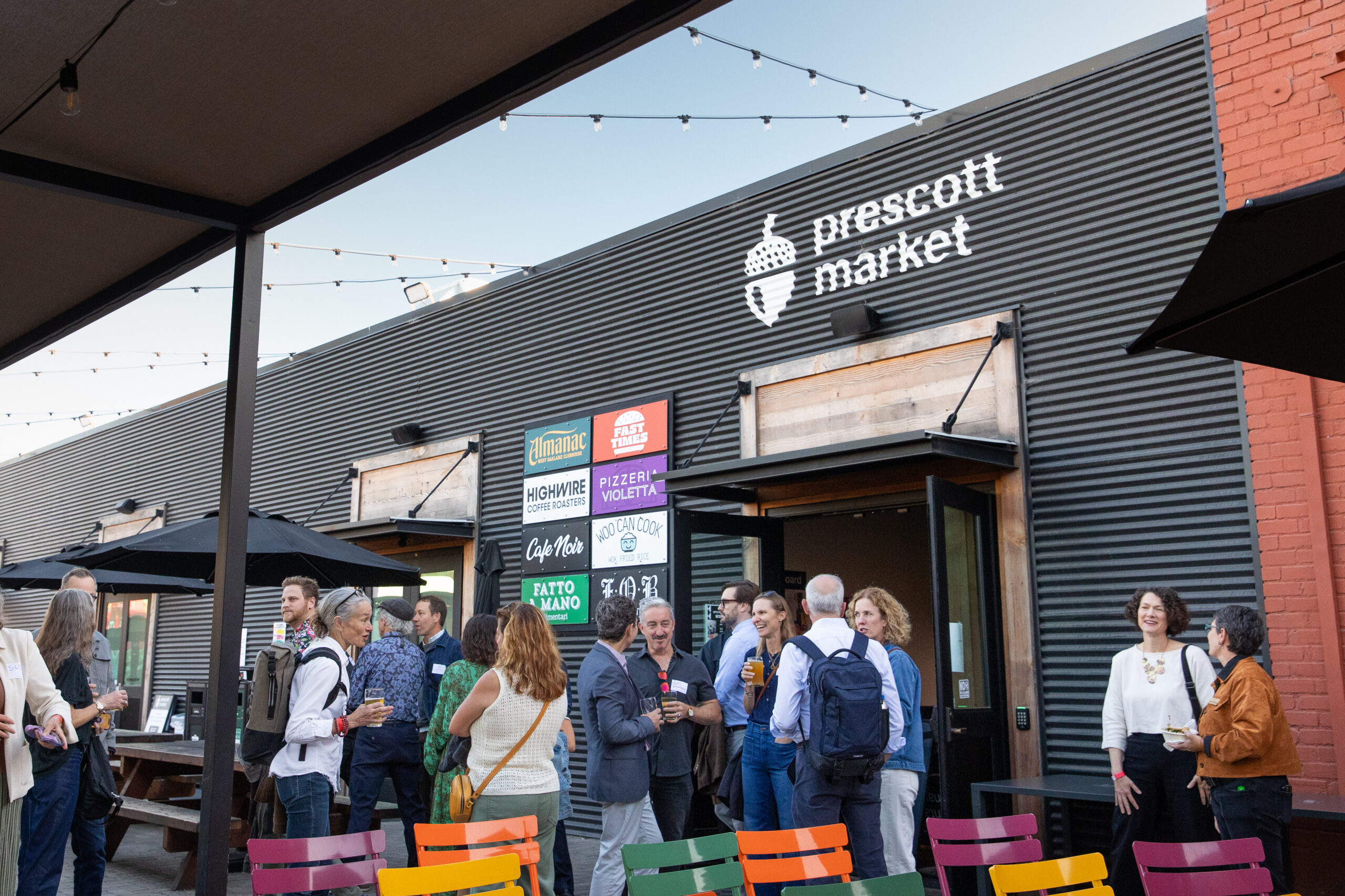
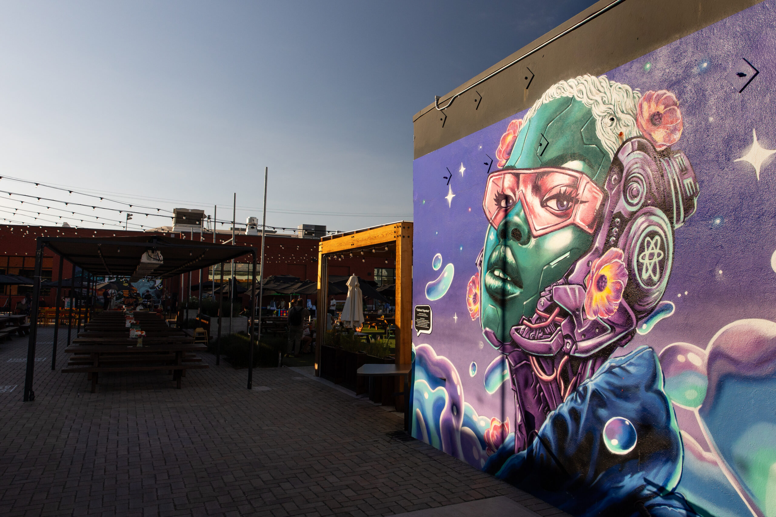
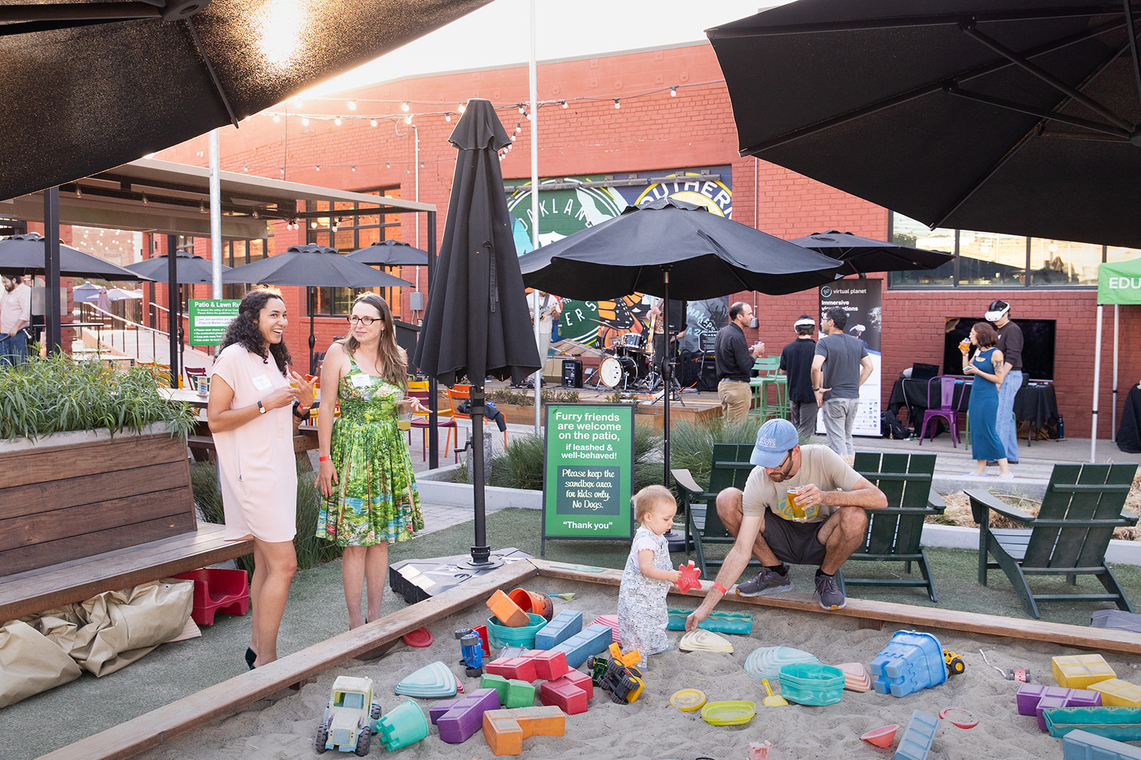
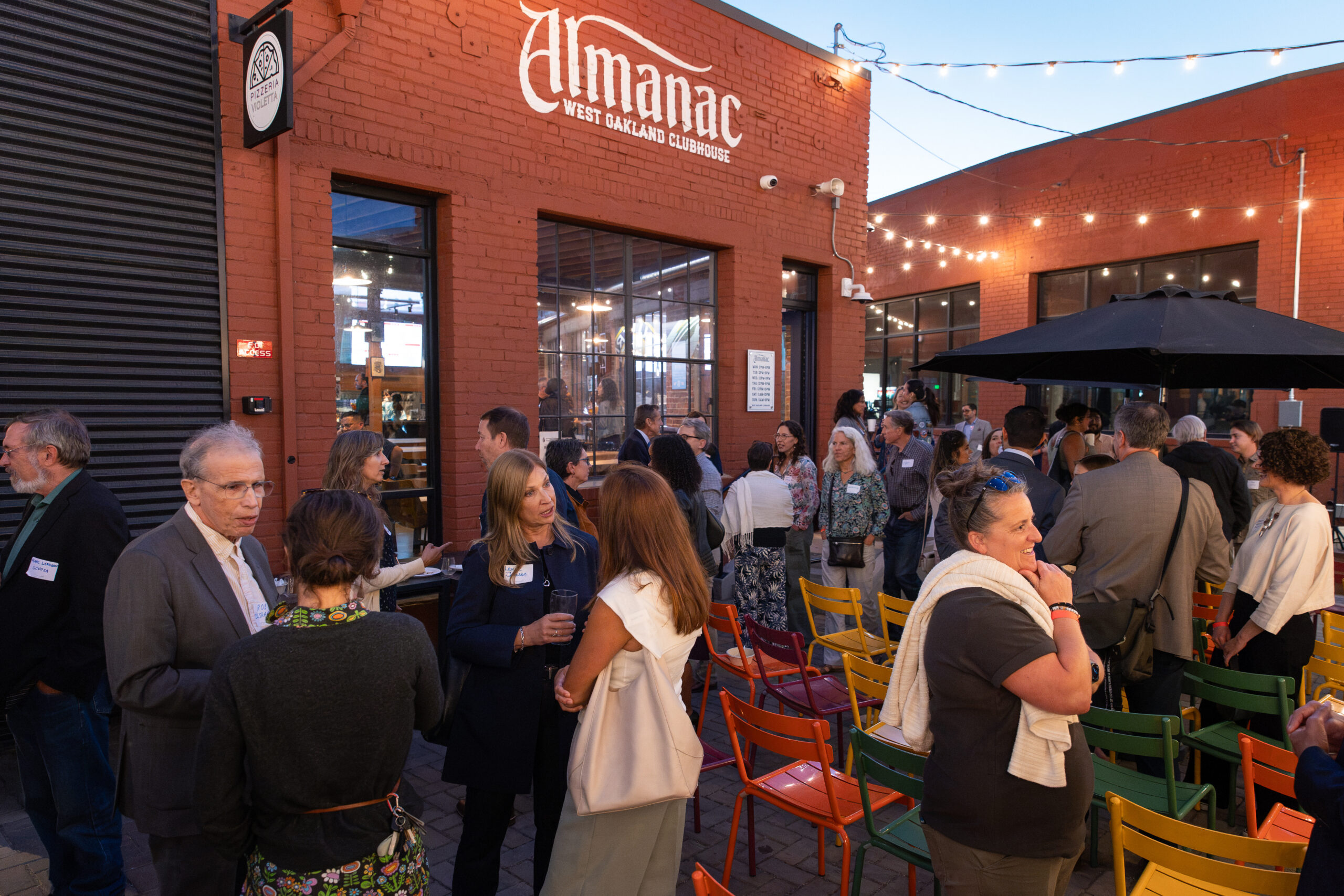
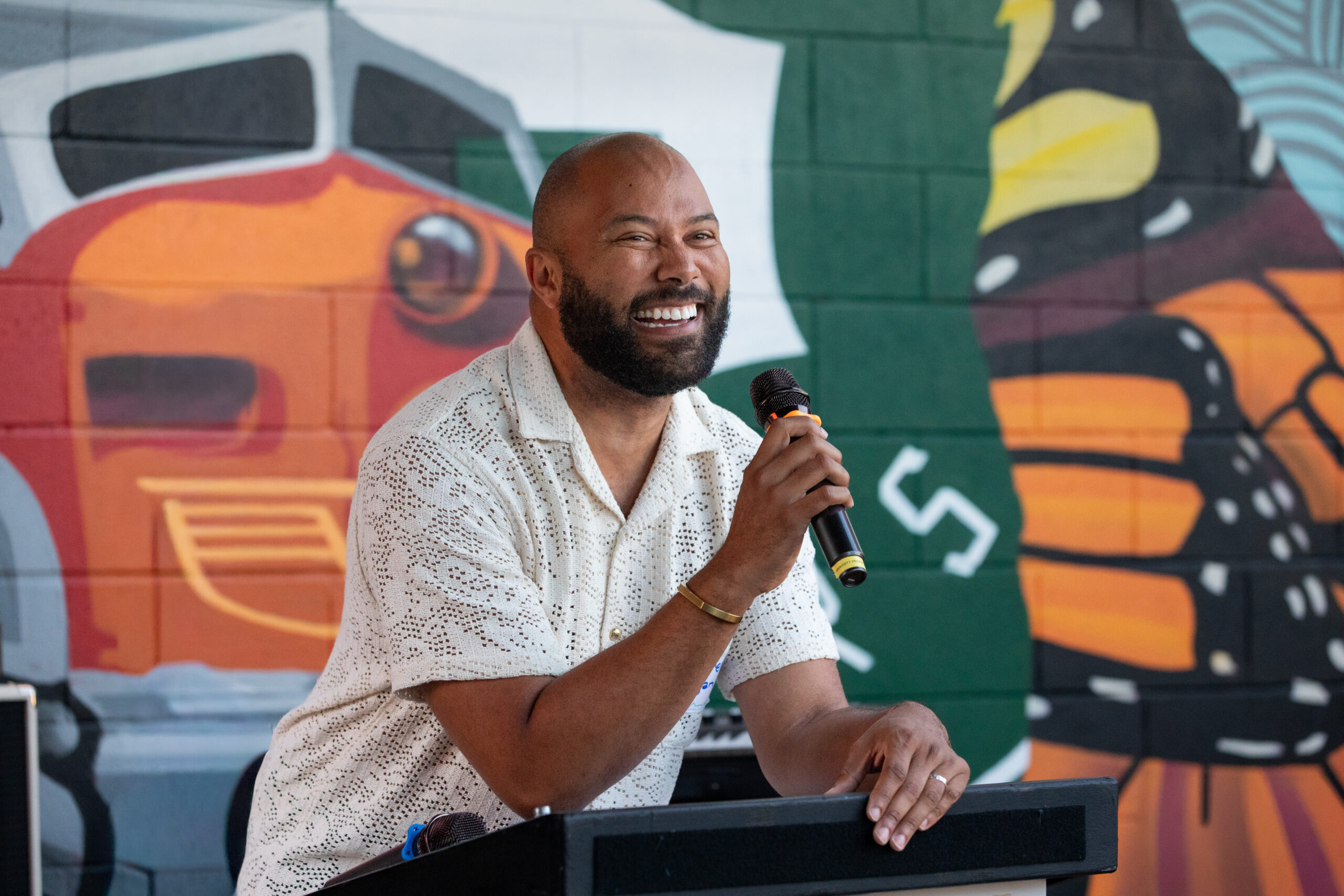
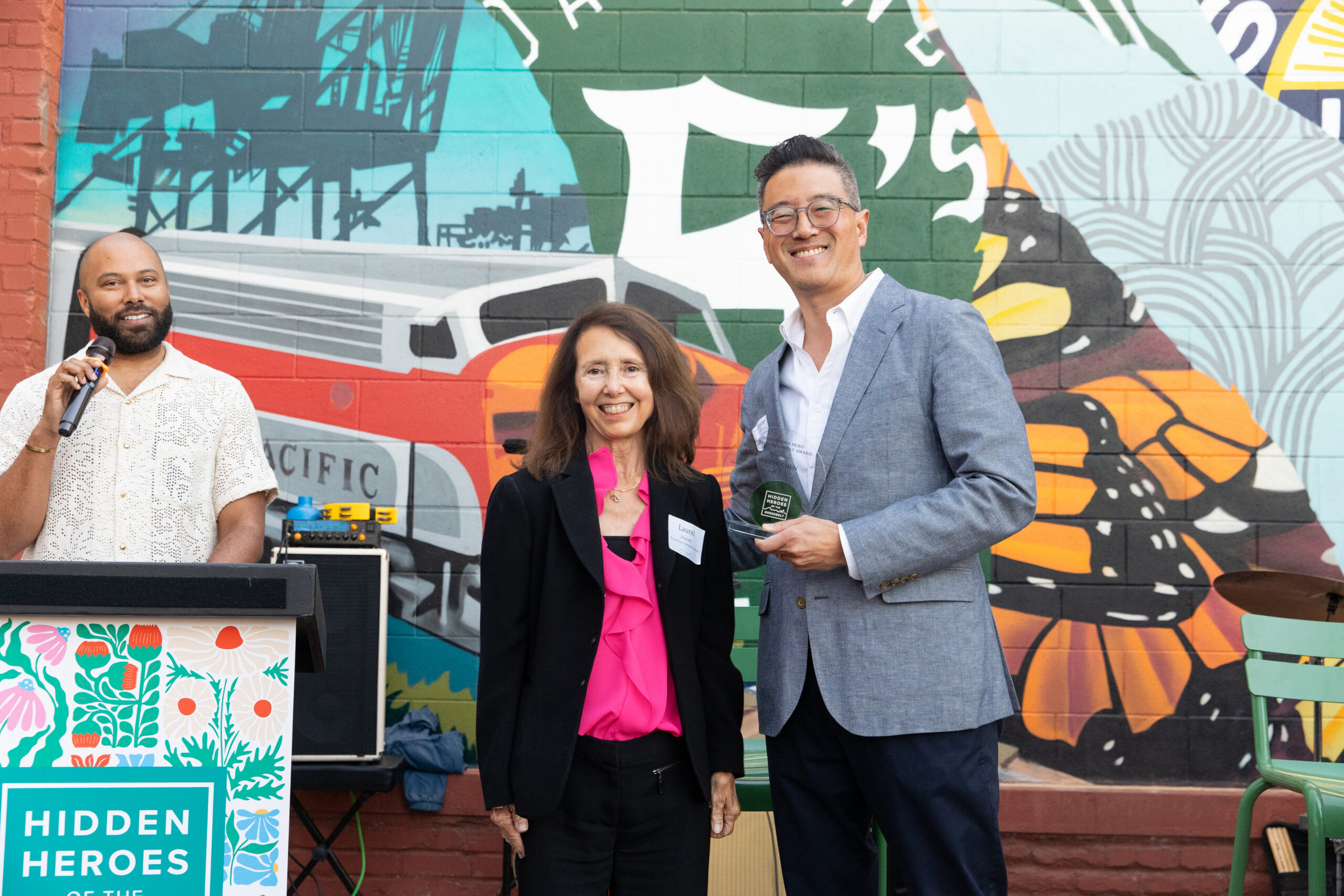
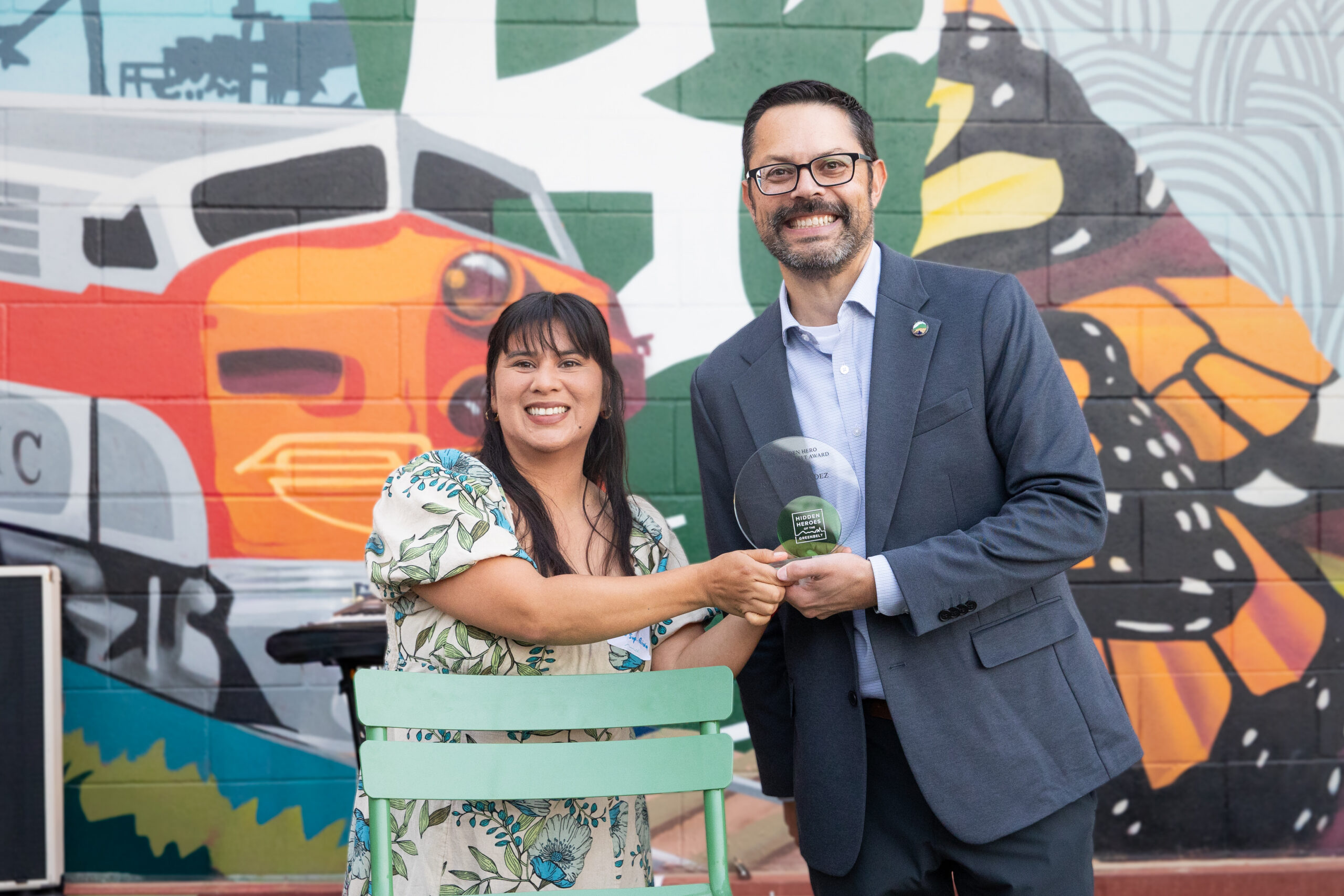
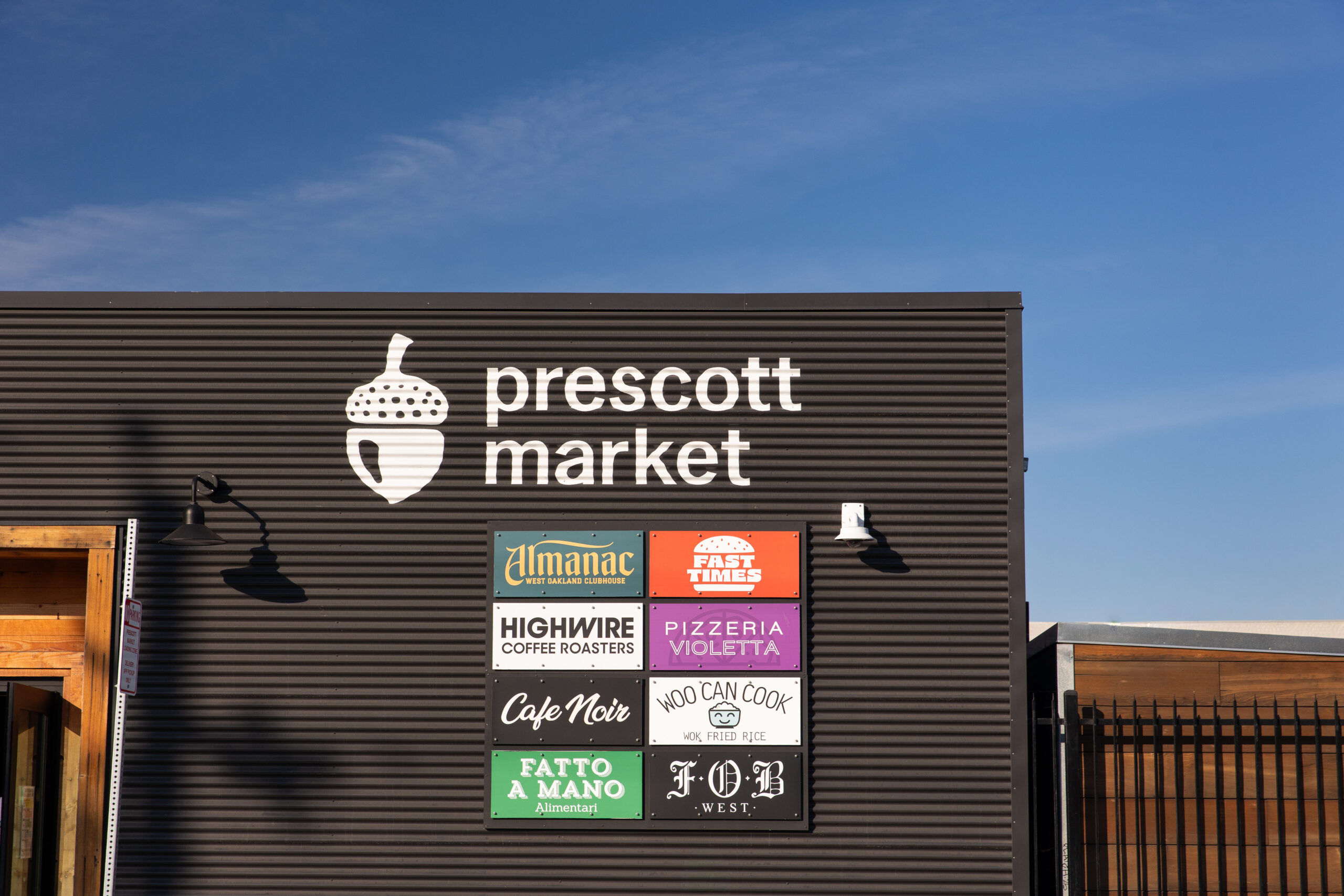
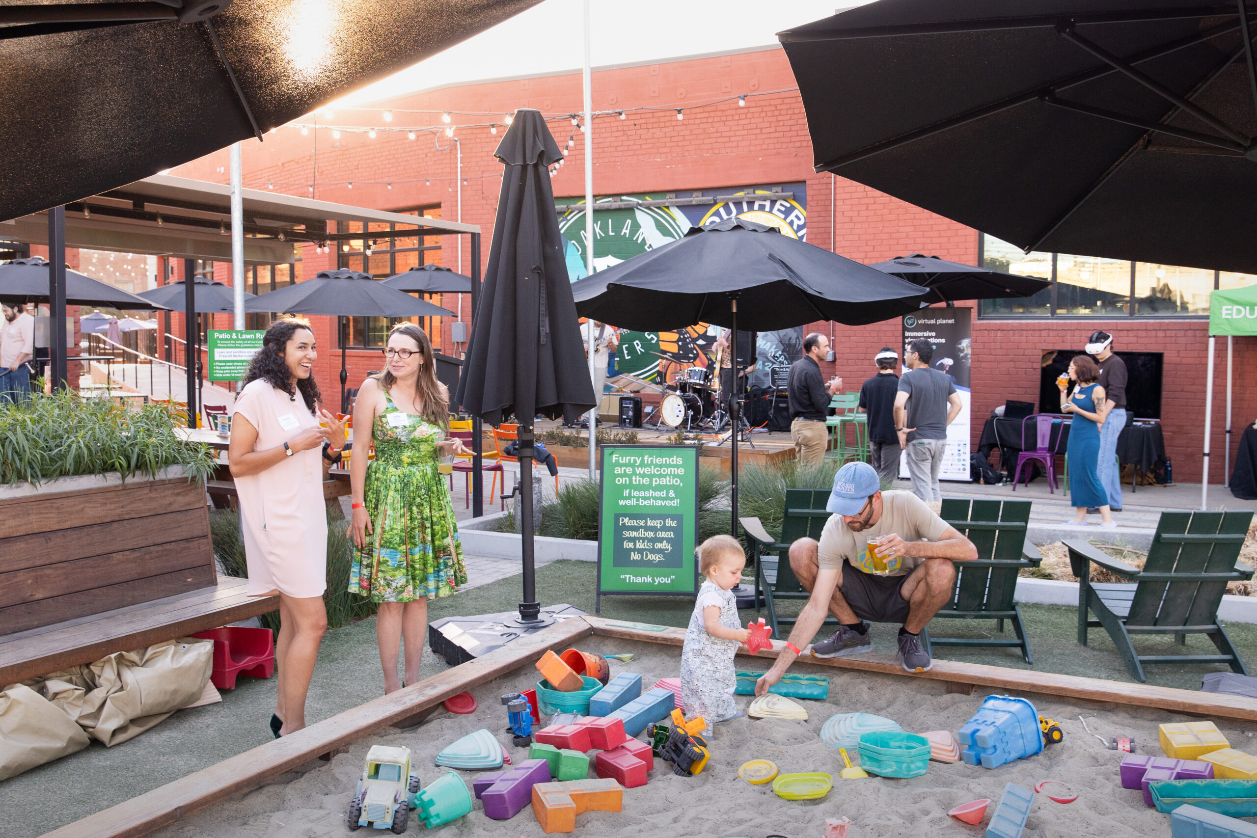
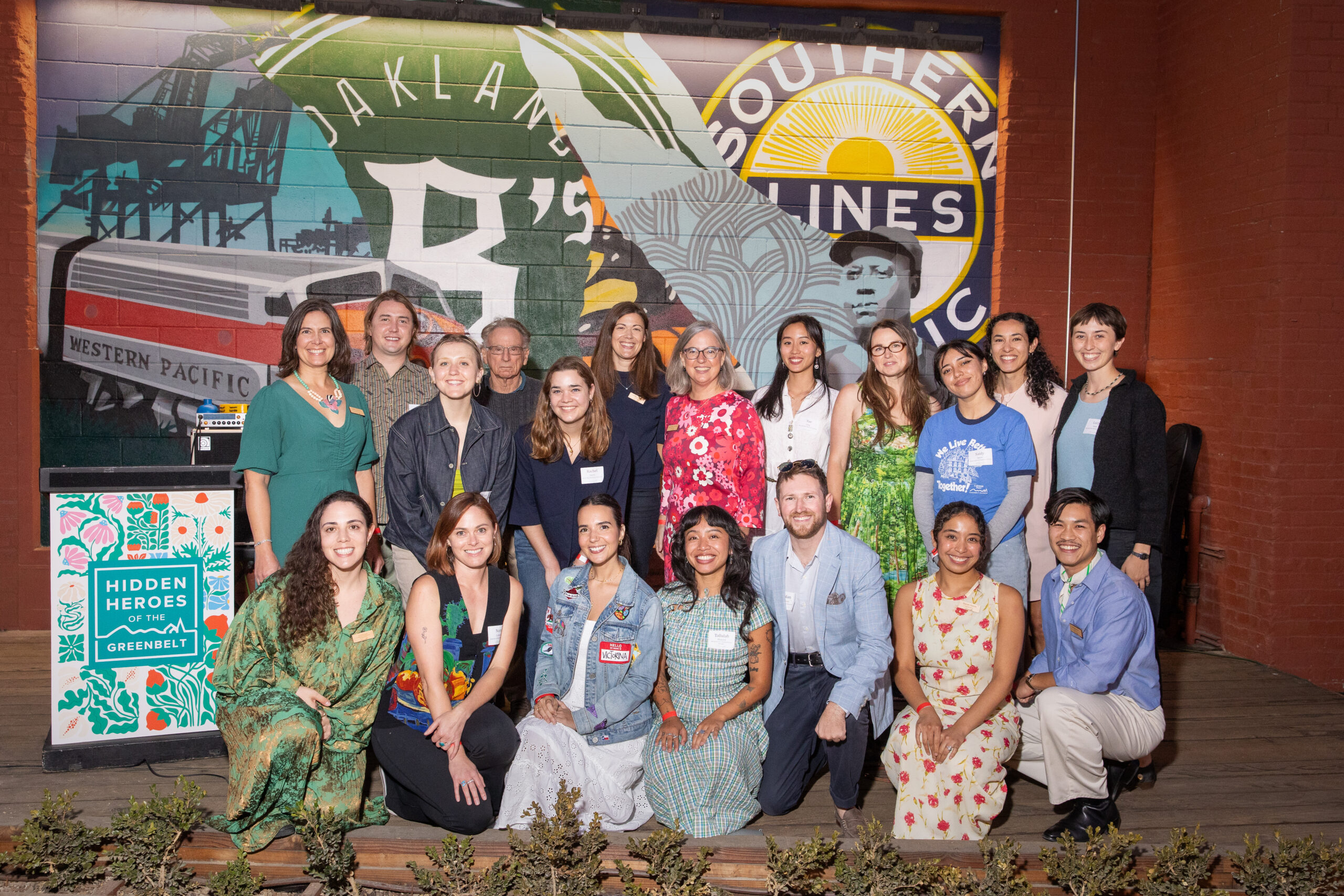
On September 23, more than 200 people came together at Prescott Market in West Oakland for the 6th Annual Hidden Heroes of the Greenbelt Benefit and Awards, an evening celebrating the people working tirelessly behind the scenes to make our Bay Area communities more resilient to climate change.
Relive the highlights of the evening CHECK OUT THE FULL ALBUM A Celebration of CommunityHidden Heroes is about more than the people we honor. It’s a gathering for everyone who believes this work matters: neighbors, advocates, funders, and friends who show up year after year because they know the Bay Area’s future depends on people like this.
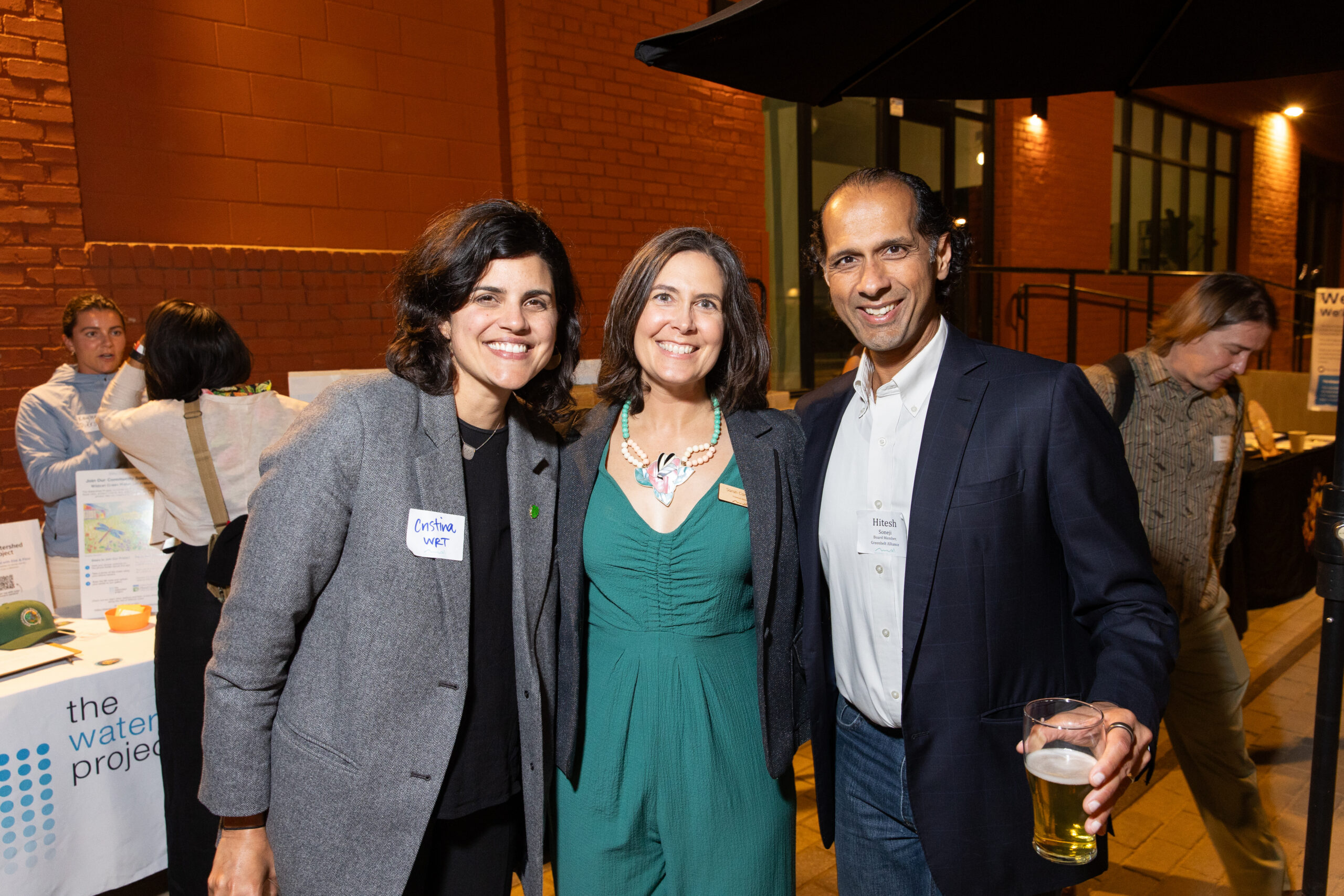
Throughout the evening, guests explored virtual reality experiences from Virtual Planet and connected with our tabling partners Hood Planning, Watershed Project, and REAP Climate Center. We’re proud to work alongside organizations like these to advance our shared mission across the region.
We’re also incredibly grateful to the 35 sponsors who helped make this celebration possible and raised funds to advance our mission-driven work.
Support goes far beyond one evening. It helps us continue the work of protecting our region’s open spaces, advancing climate resilience, and building a Bay Area where people and nature can thrive together. You can contribute today to accelerating our mission-driven work. Donate here.
To every sponsor, guest, partner, volunteer, and supporter who helped make the night happen: Thank you.
Championing HopeLocal government workers rarely receive public recognition, yet their work directly shapes how millions of Bay Area residents experience climate impacts and housing security. From county-wide plans to tackle flooding from sea level and groundwater rise to infrastructure conversion to provide housing for vulnerable populations, these leaders are spearheading the plans and initiatives that protect millions of people in the Bay Area from the impacts of the combined climate and housing crises.
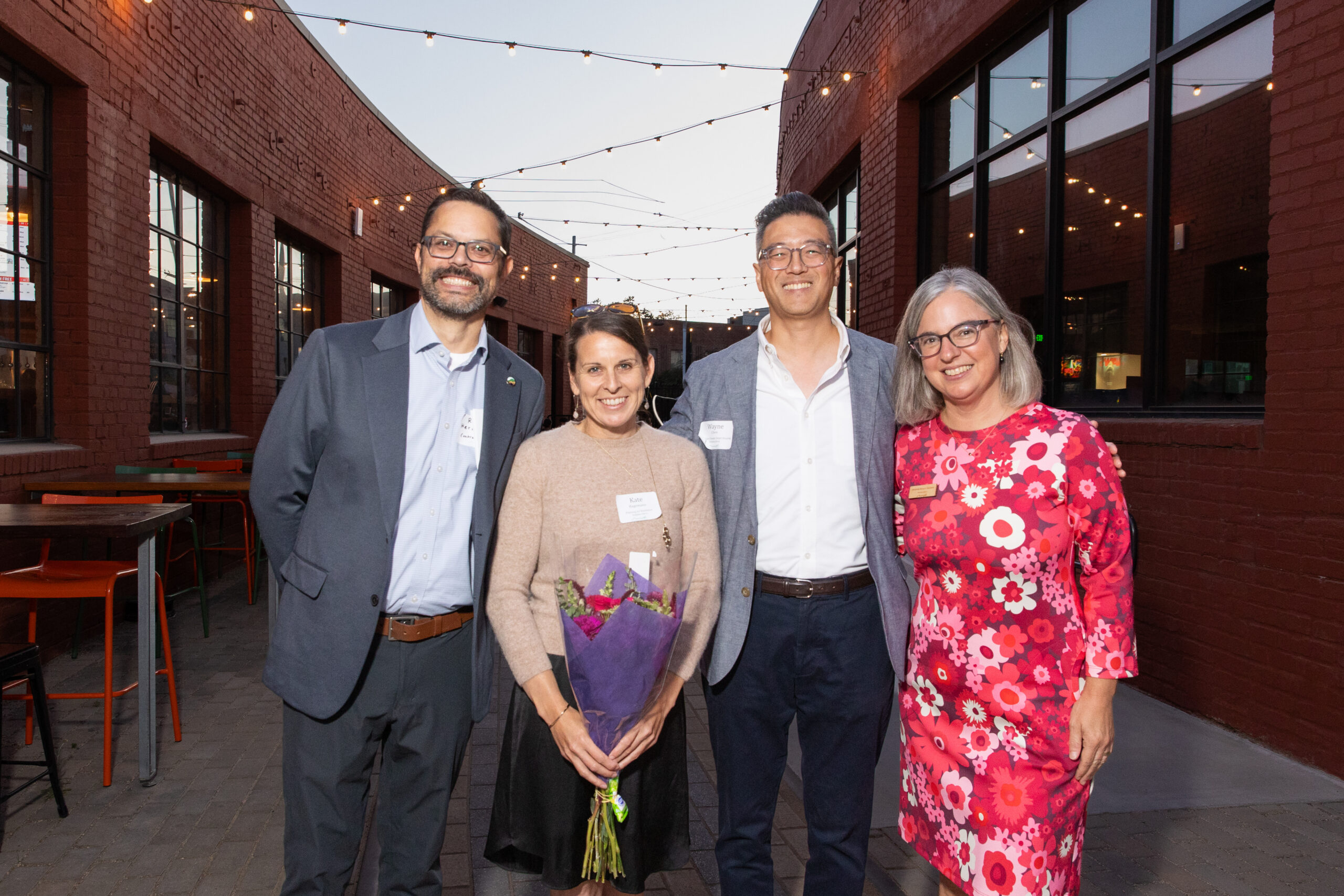
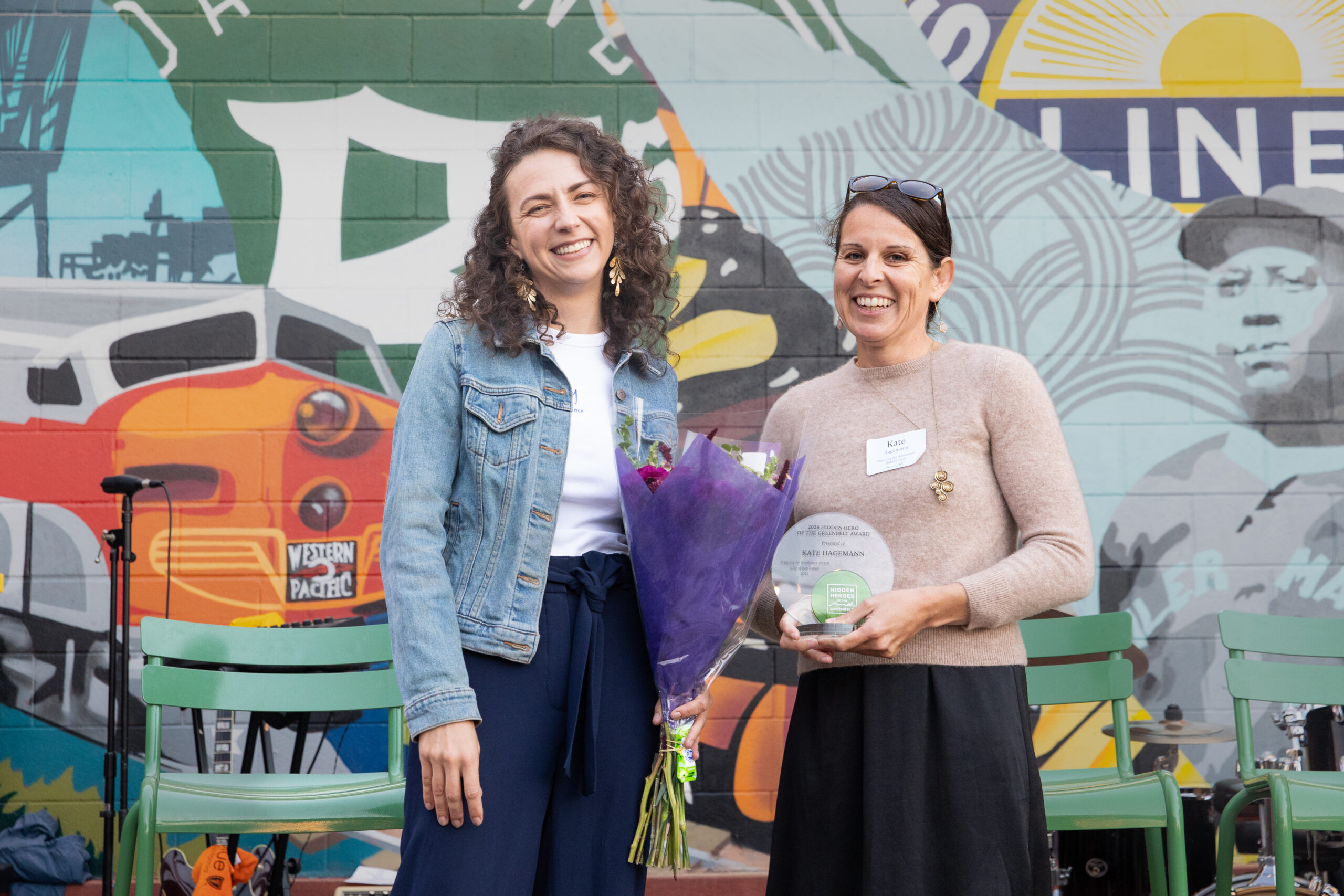
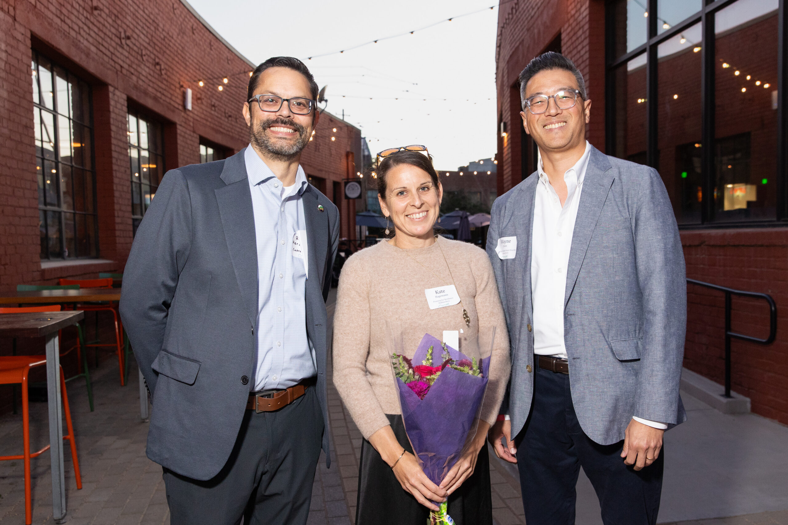
This year, we celebrated three outstanding local government leaders for pioneering solutions at the intersection of climate resilience and land use:
Kate HagemannClimate Adaptation and Resilience Planner, City of San Rafael
Kate was honored for her work advancing climate change resilience and adaptation planning, helping communities prepare for the challenges of a changing climate.
Wayne ChenDirector of Housing Department,
City of Mountain View
Wayne was recognized for his work promoting climate-smart housing and demonstrating how housing and climate resilience can be part of the same conversation.
Ryan HernandezAssistant Deputy Director,
Contra Costa County
Ryan was honored for his work advancing nature-based climate adaptation, showing how nature itself can be an important part of how communities respond to a changing climate.
Some evenings stay with you. An evening with Kate, Wayne, and Rayne will do that you: leave you convinced that the Bay Area is in good hands, and those hands are busy.
The Power to Make a Difference Is LocalAt a time when we’re seeing rollbacks on the federal level, Hidden Heroes reminds us that there is still so much we can do, right here at home.
That’s what Hidden Heroes is all about: we shine a light on the people making a difference in their communities, spark curiosity and action elsewhere, and prove that local action matters, especially when the work ahead is urgent.
Thank you for celebrating with us, supporting our mission, and being part of a community that believes we can make a difference right here at home.
The work continues. And we’re in it together.
.elementor-39197 .elementor-element.elementor-element-3007a9da > .elementor-element-populated{padding:30px 0px 30px 0px;}.elementor-39197 .elementor-element.elementor-element-7b48ef7d > .elementor-widget-container{padding:0px 0px 30px 0px;}.elementor-39197 .elementor-element.elementor-element-7b48ef7d{text-align:center;}.elementor-39197 .elementor-element.elementor-element-7b48ef7d .elementor-heading-title{font-size:35px;color:var( --e-global-color-54e1dff );}.elementor-39197 .elementor-element.elementor-element-6604725c{text-align:center;}.elementor-39197 .elementor-element.elementor-element-517afbb{text-align:center;}.elementor-39197 .elementor-element.elementor-element-26d468b{text-align:center;}.elementor-39197 .elementor-element.elementor-element-96da833{text-align:center;}.elementor-39197 .elementor-element.elementor-element-b5671ce{text-align:center;} THANKS TO OUR 2026 HIDDEN HEROES SPONSORS Climate Advocate Sponsors Land Steward SponsorsEast Bay Municipal Utility District | East Bay Regional Park District | Housing Action Coalition | Marin Community Energy (MCE) | The Morley Bros | Skidmore, Owings & Merrill LLP | SPUR | Triad Development
Community Friend SponsorsAlta Housing | Brookfield Properties | Eden Housing | Fairbank, Maslin, Maullin, Metz & Associates | Hanson Bridgett LLP | HOK | MidPen Housing | Nonprofit Housing Association of Northern California | PlaceWorks | Port of San Francisco | San Francisco Bay Area Rapid Transit District – BART | Santa Clara Valley Open Space Authority | Santa Clara Valley Water District | SCAPE Landscape Architecture | Second Nature Ecology + Design | Singer Associates Public Relations | Shute, Mihaly & Weinberger LLP | SOMO Village | Sonoma County Agricultural Preservation & Open Space District | Sonoma Land Trust | Team CivX | The Nature Conservancy | WRT
Greenbelt Ambassador SponsorEnterprise Community Partners | Mithun
The post Hidden Heroes 2026: Champions Empowering Communities for Action appeared first on Greenbelt Alliance.
Vote Yes for the Regional Transit Measure (RTM)
After a successful signature-gathering campaign by Connect Bay Area, the Regional Transit Measure (RTM) will appear on the November ballots for many Bay Area voters, and Greenbelt Alliance is excited to endorse a YES vote on RTM.
If the Regional Transit Measure passes, the roughly $1 billion in revenue per year will support public transit agencies’ improvements to safety, cleanliness, convenience, seamless integration of transit services, and specific capital projects. The new revenue will be sourced from a 1% sales tax in San Francisco County and a 0.5% sales tax in Santa Clara, San Mateo, Alameda, and Contra Costa counties.
The measure aims to prevent catastrophic funding cuts that could impact regional public transit as soon as 2027. These major impacts will particularly hurt BART, Muni, AC Transit, and Caltrain, but will have many downstream consequences for our entire region. If we don’t approve it, the Bay Area will lose its transit backbone, making our weekly commutes longer, causing a dramatic increase in pollution, and leaving us with less time to be with our friends and family.
RTM supports a resilient and sustainable future where our communities are able to use public transit with ease, and we can protect our environment from further greenhouse gas emissions from cars. Please join Greenbelt Alliance, alongside organizations such as 350 Bay Area, SPUR, and Public Advocates, in endorsing the Regional Transit Measure! Vote YES on RTM in November to save the Bay Area’s public transit and fight against climate change.
Additionally, learn more about Proposition H in San Francisco to further strengthen the Muni transit system in San Francisco.
Why It MattersThe Bay Area is facing its biggest threat to public transportation in decades. With a looming fiscal cliff, major transit agencies—including BART, Muni, Caltrain, and AC Transit—may soon have to make difficult decisions to close stations, reduce frequencies, and shorten hours of operation.
To avert this looming crisis, a coalition of advocates came together to launch the Connect Bay Area campaign. Earlier in May, the campaign announced it collected more than 305,000 signatures to qualify a regional transit funding measure for the November ballot—crushing the minimal threshold of 186,000 required signatures.
Greenbelt Alliance was proud to be part of this grassroots coalition and endorse the Connect Bay Area Campaign.
How We Got Here"The Bay Area's public transit is a core pillar of our region's ability to usher in a climate-smart, affordable, and just future. Greenbelt Alliance is excited to be a part of this grassroots coalition to help protect and enhance our public transportation and reduce pollution."
Amanda Brown-Stevens, Executive DirectorFunding for transit agencies in the Bay Area relies heavily on fares and local revenue sources, so when the COVID-19 pandemic hit and ridership plunged, a substantial amount of that funding disappeared. For a while, agencies were able to stay afloat due to the federal relief stimulus, but that has quickly dried up, and California has not stepped in to address those deficits. Without yearly State funding and with ridership only slowly recovering to pre-pandemic levels, agencies are not seeing the revenue needed to continue operating at full capacity.
To put this into perspective, here is what will happen in 2027 if we do not pass the transit measure:
Bay Area Rapid Transit (BART)- Red and Green lines will be phased down to just peak hours in January 2027. The Grey line will close at this time, too. The blue line will close in July 2027.
- 15 stations with the lowest ridership will close, including Millbrae and Warm Springs, by July 2027.
- 70% reduction in train hours and 25% reduction in system miles by July 2027.
- 30% fare increase in January 2027, and a 50% increase in July 2027.
- The agency will face a $355-$385 million budget deficit (30% of the operating budget)
- Without a funding pathway by mid-2028, BART may have to stop all operations. See more details here.
- There will be a 50% cut of Muni services
- There will be an elimination of fare discounts and pass programs for youth and seniors
- The agency will face a $322-$398 million budget deficit (25% of the operating budget)
- There will be a nearly 40% cut to services
- The agency will face a $51-$72 million budget deficit (10% of the operating budget)
- The agency will run 1 train per hour and cut all weekend service
- The agency will face a $65-$76 million budget deficit (42% of the operating budget)
These monumental disruptions to operations are direct consequences of the fiscal cliff. However, it does not account for the myriad ramifications down the road for managing traffic, tackling climate change, meeting our housing needs, and ensuring an affordable California for all.
“Fuming” with Greenhouse GasesWith 41% of California’s greenhouse gas emissions coming from the transportation sector, losing major parts of our public transit system will allow for even more cars on the road and weaken our ability to fight the climate crisis. Without BART, drivers can expect their commute to extend by 12 more hours per week and see traffic across the Bay Bridge surging by 73%. This means less time with family and friends doing the things we love.
In the long term, this may lead to worsening climate hazards, including droughts, flooding, and wildfires. More cars will also be a direct threat to our health and well-being, causing more air pollution, compromising air quality, and increasing respiratory-related illnesses. By maintaining our public transit system, we can reduce GHG emissions and avoid these catastrophic changes to our communities.
Communities Connected to TransitThree words encapsulate our housing abundance strategy: transit-oriented development (TOD). In the last two decades, many urbanists have turned their attention to creating walkable, affordable, and resilient communities that are well-connected to the places where people work, study, and play. A cornerstone of this vision is built on the idea that we should promote more homes near our public transit corridors.
BART TOD projects like MacArthur Station provide residents access to the vibrant Temescal neighborhood, while allowing easy access to commute to downtown Oakland or San Francisco. Even new project proposals like the Caltrain-adjacent Hillsdale Reimagined in San Mateo demonstrate the durability of TOD in renovating underutilized buildings and turning them into lively community spaces.
That is why Greenbelt Alliance co-sponsored Senate Bill 79 in the California legislature, which makes it easier and faster to build homes near public transit. While SB 79 is now law, the risks of public transit’s fiscal cliff diminish the law’s application by making fewer sites viable for TOD upzoning. Other proposed TOD projects funded by transit agencies will likely be reevaluated, too. This could all delay much-needed affordable housing in the Bay Area and worsen the housing crisis.
Saving public transit goes far beyond just our means of commuting. A healthy public transit system reduces traffic, protects us from pollution, reduces GHG emissions, creates resilient neighborhoods, and supports new housing.
This November, vote YES on the Regional Transit Measure.
The post Vote Yes for the Regional Transit Measure (RTM) appeared first on Greenbelt Alliance.
Vote Yes on Proposition H to Keep Muni Going Strong in San Francisco
For healthier and well-connected communities, Greenbelt Alliance encourages voters in San Francisco to say YES to Proposition H to secure funds for Muni and keep light rail, buses, and cable cars running.
Proposition H, or Stronger Muni for All, is focused on providing financial support for public transit in San Francisco and preventing a once-in-a-generation funding crisis. The proposition will address Muni’s major annual deficit of over $300 million and ensure that the agency is safe, reliable, and affordable. If it passes, Prop H would establish a fair tiered parcel tax that charges 95% of single-family residences a flat $129 annual fee. Larger homes would pay progressively more, and the largest commercial properties would pay up to $400,000 annually. This ensures that average San Franciscans are not burdened by higher taxes while the biggest properties are paying the most.
Along with organizations such as Transform, SF Transit Riders, and the Sierra Club, we endorse Prop H because a healthy, resilient, interconnected, and sustainable future necessitates a strong public transit system.
This ballot measure is complementary to the Regional Transit Measure (RTM)‘s goals and will support the region by significantly reducing traffic congestion, reducing greenhouse gas emissions, and protecting downtown and citywide economic recovery. Vote YES to save Muni and protect our environment.
Photo: L Taraval shuttle bus during Twin Peaks Tunnel construction. By Pi.1415926535 – Own work, CC BY-SA 3.0, https://commons.wikimedia.org/w/index.php?curid=69525140
The post Vote Yes on Proposition H to Keep Muni Going Strong in San Francisco appeared first on Greenbelt Alliance.
Vote No on Measure G to Keep Sunset Dunes Park Open in San Francisco
Greenbelt Alliance says NO to Measure G in San Francisco to save the Sunset Dunes Park and keep the 2-mile stretch of the Upper Great Highway along Ocean Beach closed to cars and open for people every day. Measure G proposes to reopen the road on weekdays. The campaign says the road would remain part of the car-free park on weekends.
In 2024, we endorsed Proposition K to close this segment of the highway to first establish this stretch of Ocean Beach as a park open to the public. Prop K was successful and won on the ballots, and since then has seen a huge turnout of people, as the city’s 3rd most visited park.
According to KQED, “the majority of voters who live closest to the Great Highway opposed its closure in 2024, and its status remains at the center of west side politics, leading to the recall of District 4 Supervisor Joel Engardio in 2025 and a now-dismissed lawsuit challenging Proposition K.” Measure G campaign claims that reopening this stretch of the road would lead to better road safety; however, this claim is being denied by pedestrian-safety advocates, including partners like SPUR, who say the campaign’s “new branding misappropriates street-safety imagery and falsely suggests that the proposition would increase neighborhood safety.”
Why It MattersDuring the COVID-19 pandemic, in 2020, a portion of the Upper Great Highway along Ocean Beach closed to cars and welcomed residents to enjoy the highway as a recreational and social public space. But this arrangement was set to expire in 2025, and Proposition K established a permanent closure and oceanside park
Climate change is currently causing parts of Ocean Beach to erode and making the highway unreliable and threatening its longevity and safety. Before the permanent closure, the highway was already closed up to 65 days per year due to sand removal, costing the City nearly $2 million annually.
Voters have just recently weighed in on the same question, and they said YES to open spaces for public recreation. We support Sunset Dunes again in 2026 and urge voters to vote No on Measure G in San Francisco.
Photo from Friends of Sunset Dunes website.
The post Vote No on Measure G to Keep Sunset Dunes Park Open in San Francisco appeared first on Greenbelt Alliance.
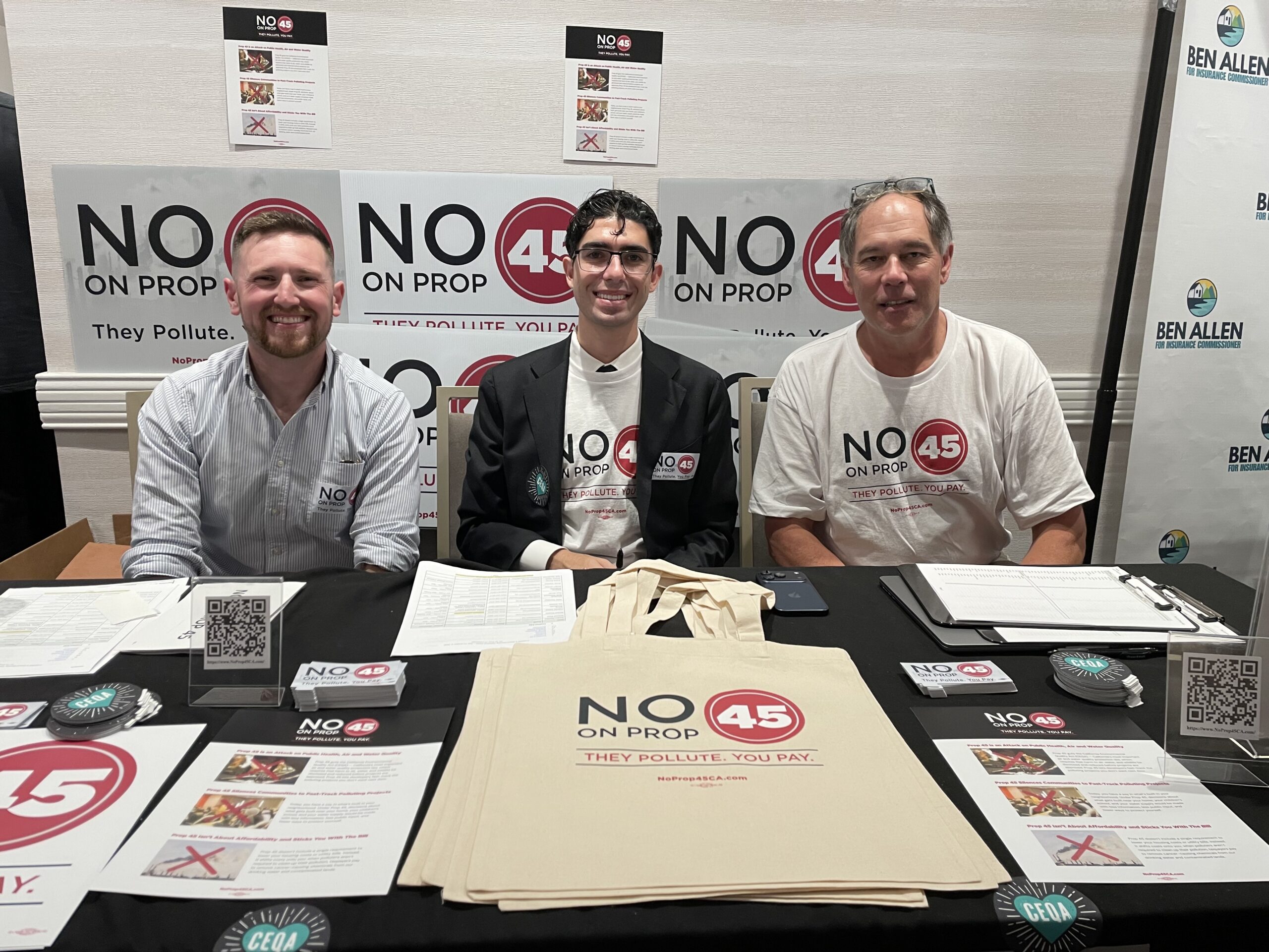
Vote No on Prop 45: Rolling Back CEQA Is A Proposition Californians Can’t Afford
Updated on September 23 to include links and additional information. Originally published on January 16, 2026.
For advocates working at the intersection of environmental protection and climate-smart growth, the California Environmental Quality Act (CEQA) has long been a source of both pride and frustration. While it has been a critical tool to protect our natural and working lands, its procedural delays have often been used to stall projects essential to a low-carbon future: dense infill housing and transit-oriented development in our existing communities.
In July 2025, however, at the urging of Governor Newsom, the California legislature passed some of the most impactful changes to CEQA since its inception. Taken together, the two bills (AB 130 and SB 131) provide robust statutory CEQA exemptions for infill housing and housing element rezonings, require the state to map infill areas where exemptions would apply, and narrow the scope of the administrative record, helping to curtail anti-housing litigation.
Despite these monumental changes that address the barriers to critical infill development, California’s business lobby and sprawl developers were left unsatisfied. Now, they are proposing a ballot initiative that would make far more radical changes to the law. After gathering enough signatures to qualify for the November ballot, this is now called Proposition 45.
While the rhetoric of the measure (initially called Building an Affordable California Act, or BACA) seems to be aligned with urbanist goals and those of the broader abundance and affordability movements, the actual policy details and mechanics of the initiative—and the progress we’ve already achieved in the legislature last year—suggest that the costs it brings far outweigh any potential benefits.
Below, we outline seven reasons why the measure should be rejected (click to read more):
1. Major Reforms Have Already Been EnactedFor years, a primary objective for California’s urbanists was to stop the abuse of environmental law against projects that genuinely help the environment: dense, transit-oriented housing.
In a landmark shift for the state, that goal has largely been realized. Following years of advocacy by urbanists, the legislature passed a clean statutory CEQA exemption for infill housing. AB 130, which Greenbelt Alliance was proud to support, is already being utilized across California, allowing builders to move forward with climate-friendly housing in high-opportunity areas like Palo Alto or Beverly Hills without the threat of being endlessly delayed by the environmental review process. While there is room for technical refinements, the fundamental issue at hand—the misuse of environmental laws to delay environmentally-friendly housing projects—has largely been addressed.
As the saying goes, “the devil is in the details”, and that’s certainly true for the BACA initiative. While modest on the surface, BACA creates a completely new set of rules for what it calls “essential” projects. So what, exactly, is an “essential project”?
The list is incredibly broad. Under Article 2, Section 21013, “essential projects” include housing, water, transportation, clean energy, transmission, broadband, and healthcare infrastructure. In practice, this definition encompasses a wide range of large-scale developments. For example, new freeways and existing freeway expansions would qualify as “essential transportation” projects; large greenfield sprawl developments would be treated as “essential” housing projects; and new dams and reservoirs would qualify as “essential” water projects. The definition even includes all “related and ancillary infrastructure,” meaning that highway interchanges, utility extensions, and water pipelines that enable sprawl developments also receive streamlined approval. All of these are enormous projects in terms of size and scale, with major potential environmental impacts. Yet, just like an apartment building in an urban area, under BACA, they would qualify for a significantly truncated review process.
In effect, this new CEQA process mirrors the fundamental flaw of its predecessor. While the old system failed to exempt low or no-impact projects from excessive review, the new one errs in the opposite direction, fast-tracking high-risk developments with significant potential for harm.
3. All Timelines Are Not Created EqualThe BACA initiative imposes strict timelines for this new class of projects that it deems “essential”: the environmental review process can take no more than one year. On the surface, a one-year limit on an Environmental Impact Report (EIR) seems reasonable. And for certain projects, like an apartment building on a parking lot in downtown San Francisco, or a townhome development in an LA suburb, it would be.
However, the measure’s definition of “essential” includes highways, dams, large-scale subdivisions, and other major projects. The environmental review required for projects at this scale cannot be done in a single year. Surveying hundreds if not thousands (or even tens of thousands) of acres of undisturbed and undeveloped land for species nesting patterns and habitat, water pollution impacts, and other environmental concerns physically cannot be accomplished within the timeframe laid out in the initiative. By forcing these projects into such a condensed timeline, we will be creating a system that overlooks genuine environmental harm in favor of speed.
For projects with unambiguous environmental benefits, such as housing developments within already urbanized areas, such speed makes sense. Many of the project types considered by this measure do not have the same clear, unambiguous benefits.
4. Restrictive AlternativesOne of CEQA’s most critical tools for preventing environmental harm is its alternative analysis provision, which allows for the identification of better project locations and designs. Currently, CEQA requires agencies to analyze a “reasonable range of alternatives” that could reduce environmental impacts, including different sites, reduced intensity options, and designs that avoid sensitive resources. This is how agencies can say, “this housing should be built downtown on a parking lot instead of on farmland,” or “this highway expansion has an alternative transit solution.”
BACA restricts this to just three options: the proposed project, one alternative designed by the applicant themselves (which doesn’t even need to be at a different location), and “no project.” The applicant’s alternative can be a slightly modified version of their original proposal on the same site. This eliminates the core mechanism for steering projects away from environmentally sensitive locations toward more appropriate sites, exactly the tool needed to prevent sprawl, protect open space, and ensure development happens in the right places.
5. The Evidentiary StandardMaybe the most radical change incorporated in the ballot measure is to CEQA’s standard of review. Right now, CEQA allows a lead agency (generally a city or county) to use its own discretion to explore project alternatives and negotiate environmental mitigations. BACA proposes to eliminate this by requiring that environmental impacts only be found significant if they violate objective, quantifiable standards already in existing law when the project was proposed, which doesn’t sound inherently unreasonable!
However, the measure doesn’t actually require jurisdictions to adopt such standards; instead, it exploits their absence. If numerical thresholds don’t already exist for resources like oak woodlands, groundwater, or wildlife corridors, impacts to them essentially can’t be found significant regardless of severity. A genuine objective standards approach would mandate jurisdictions adopt protective thresholds and update them as science improves. This measure rewards weak standards, freezes them at application date, and prevents improvements based on new knowledge.
6. Ballot Box PermanenceFinally, one of the greatest flaws of the measure is its rigidity. Should it pass, BACA would require a 2/3rds vote of the legislature to amend.
California has a long, storied history with ballot box governance, where initiatives become impossible to adjust as new problems arise. The 2/3rds requirement virtually guarantees the law could never be changed, regardless of what issues may arise. An unchangeable measure, with foreseeable negative impacts for the state, may have lasting consequences for generations.
Some of the project types included in this measure, such as clean energy or transmission infrastructure, may benefit from the types of streamlining being considered if careful, targeted changes were made. Rather than a broad, clunky initiative that will be extremely difficult to change, we should advocate for those reforms through the legislative cleanup process already underway.
7. The Costs Are Just Too HighCalifornia faces converging affordability crises: insurers fleeing the state, utility rates climbing, and municipal budgets straining under unsustainable costs. All of these issues stem from the same source: decades of sprawling outward, often into fire-prone areas, leaving us with infrastructure we cannot afford to maintain and risks we cannot afford to insure.
BACA will accelerate these failures by trading short-term speed for permanent costs. By gutting CEQA’s alternatives analysis—the primary tool for steering projects away from costly, high-risk locations—this limits agencies to the developer’s preferred site, one alternative the developer designs themselves, and “no project.” It freezes environmental standards at the date of application, rewarding jurisdictions with weak protections. And it requires agencies to approve permits within strict timelines regardless of fiscal consequences, because most cities lack the quantitative standards BACA requires to find fiscal impacts “significant.”
The result: even if we build some things faster today, we’ll be paying the tab forever. Even more homes in fire zones will continue to destabilize our insurance markets. More infrastructure extensions will push up our utility rates. More sprawling subdivisions that generate less revenue than they cost to maintain will ensure even higher taxes. BACA promises affordability through speed but delivers the opposite: cheaper to build, but financially ruinous to sustain.
At a time when people are struggling to make ends meet, and when the federal government is doing all it can to roll back our environmental protections, the last thing we need is to double down on the failed policies we have tried for decades and know do not work.
Proposition 45 will hurt the environment and your wallet.
Greenbelt Alliance strongly opposes Proposition 45 and urges voters to vote NO on 45 this November.
The post Vote No on Prop 45: Rolling Back CEQA Is A Proposition Californians Can’t Afford appeared first on Greenbelt Alliance.
The Fine Print I:
Disclaimer: The views expressed on this site are not the official position of the IWW (or even the IWW’s EUC) unless otherwise indicated and do not necessarily represent the views of anyone but the author’s, nor should it be assumed that any of these authors automatically support the IWW or endorse any of its positions.
Further: the inclusion of a link on our site (other than the link to the main IWW site) does not imply endorsement by or an alliance with the IWW. These sites have been chosen by our members due to their perceived relevance to the IWW EUC and are included here for informational purposes only. If you have any suggestions or comments on any of the links included (or not included) above, please contact us.
The Fine Print II:
Fair Use Notice: The material on this site is provided for educational and informational purposes. It may contain copyrighted material the use of which has not always been specifically authorized by the copyright owner. It is being made available in an effort to advance the understanding of scientific, environmental, economic, social justice and human rights issues etc.
It is believed that this constitutes a 'fair use' of any such copyrighted material as provided for in section 107 of the US Copyright Law. In accordance with Title 17 U.S.C. Section 107, the material on this site is distributed without profit to those who have an interest in using the included information for research and educational purposes. If you wish to use copyrighted material from this site for purposes of your own that go beyond 'fair use', you must obtain permission from the copyright owner. The information on this site does not constitute legal or technical advice.
 This site is not the official webpage of the Industrial Workers of the World.